Within Sellafield Robots
How Robots Map Sellafield Before Clean Up
LiDAR, cameras and radiation sensors let engineers build detailed digital maps before deciding how contaminated material can be removed safely.
On this page
- Why engineers must investigate before dismantling
- How Li DAR and radiation data create digital maps
- How mapping changes retrieval and demolition plans
Page outline Jump by section
Introduction
Before engineers can dismantle some of Sellafield’s oldest nuclear facilities, they must first answer a deceptively simple question: what is actually inside? Many of the site’s legacy buildings were constructed in the early decades of Britain’s nuclear programme, and records are often incomplete, outdated or unable to capture decades of corrosion, structural change and radioactive contamination. Entering these environments simply to investigate may expose workers to unnecessary radiation or industrial hazards.
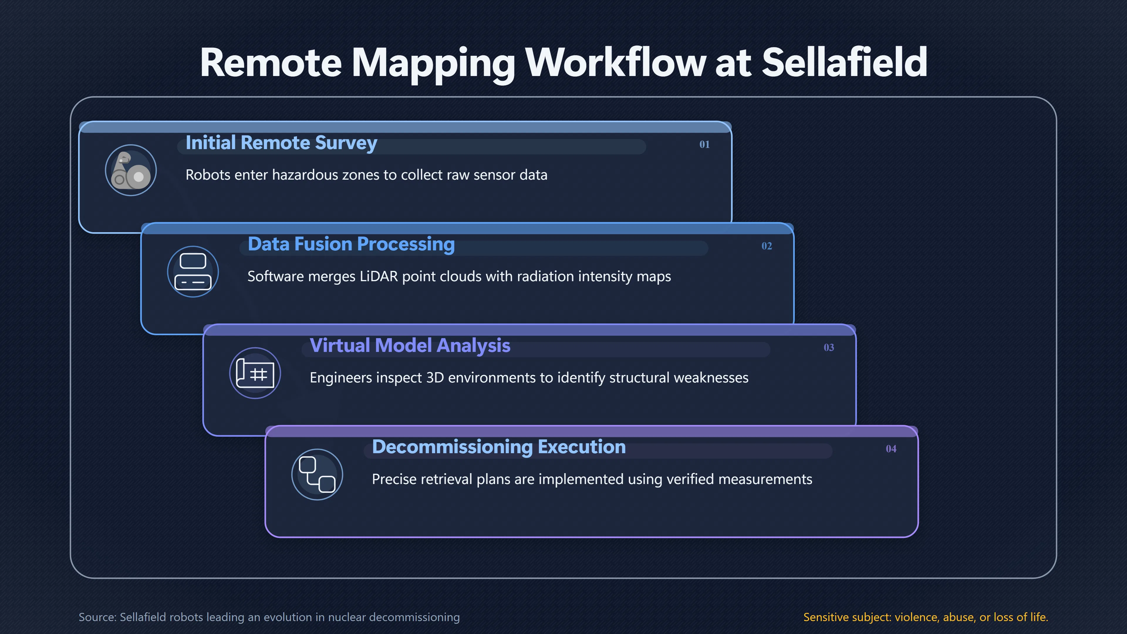
Remote mapping solves this problem by allowing robots to build detailed digital representations of hazardous spaces before major decommissioning work begins. Using combinations of LiDAR (laser-based three-dimensional scanning), high-resolution cameras, radiation detectors and other environmental sensors, remotely operated vehicles reveal hidden obstacles, contamination patterns and structural features that would otherwise remain unknown. These digital surveys reduce uncertainty, improve safety and allow engineers to design far more accurate retrieval and demolition plans. They also illustrate a broader theme within the AI Bloom perspective: intelligent machines can increasingly remove people from dangerous work while expanding humanity’s ability to understand and manage complex environments.[GOV.UK]GOV.UKSellafield robots leading an evolution in nuclear decommissioningSellafield robots leading an evolution in nuclear decommissioning
Why Engineers Must Investigate Before Dismantling
Unlike modern industrial facilities, many Sellafield buildings were never designed with eventual dismantling in mind. Waste was stored using practices that reflected the knowledge and priorities of the time, and some facilities have remained inaccessible for decades.
This creates several layers of uncertainty before any clean-up begins:
- Internal layouts may no longer match historical drawings.
- Equipment may have shifted, collapsed or corroded.
- Radioactive contamination can be unevenly distributed.
- Flooded areas, sludge or accumulated debris may conceal hazards.
- Structural damage may make human entry unsafe even where radiation is manageable.
These unknowns matter because decommissioning is fundamentally a planning exercise. Before selecting cutting tools, robotic manipulators or waste retrieval systems, engineers need reliable information about both the physical environment and the radiological conditions.
Remote mapping therefore becomes the first operational stage rather than a secondary inspection task. It transforms an unknown space into one that engineers can measure, model and analyse without placing workers inside unnecessarily.[UK National Nuclear Laboratory]uknnl.comUK National Nuclear Laboratory Decommissioning at SellafieldUK National Nuclear LaboratoryDecommissioning at Sellafield - United Kingdom National Nuclear Laboratory…
How LiDAR and Radiation Data Create Digital Maps
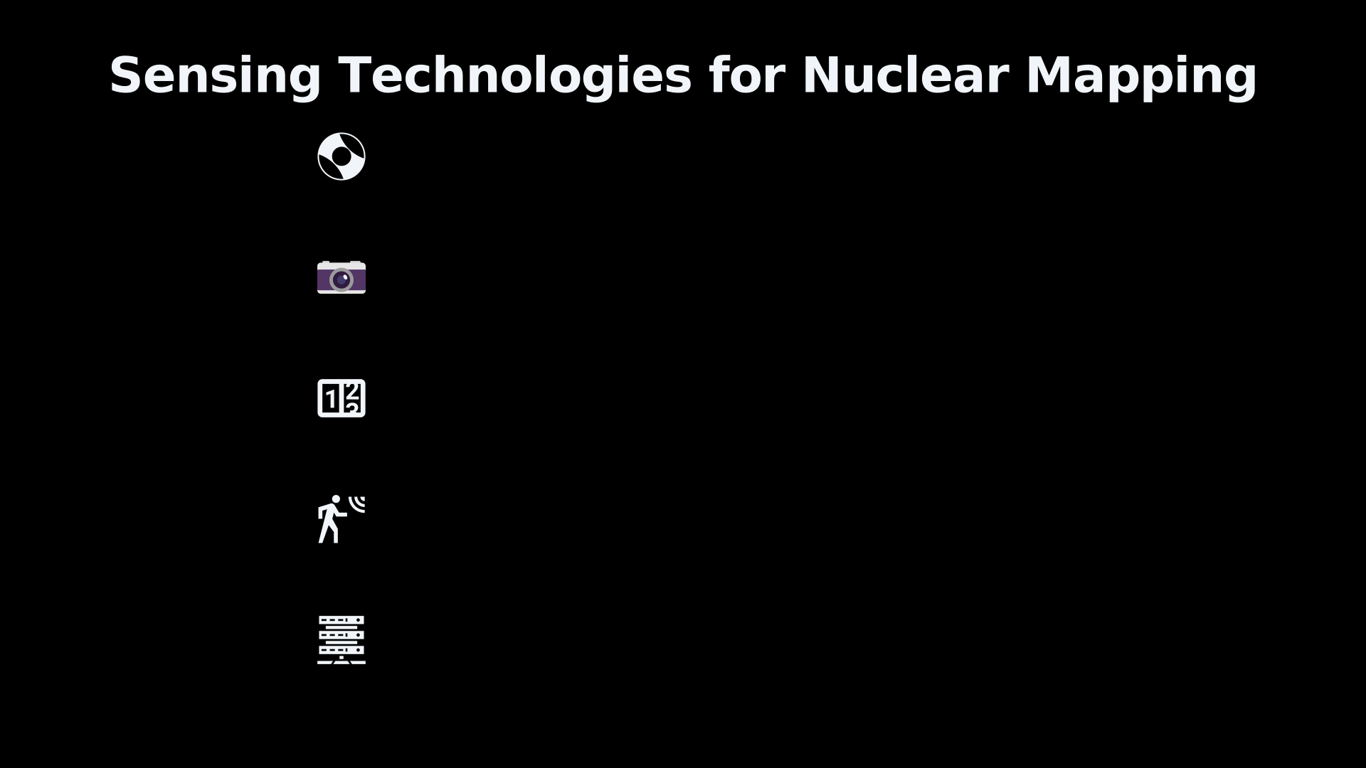
Remote mapping combines several complementary sensing technologies rather than relying on a single instrument.
LiDAR works by rapidly emitting laser pulses and measuring how long they take to return after striking surrounding surfaces. Millions of measurements are combined into an accurate three-dimensional “point cloud” that reproduces walls, machinery, pipework and debris with remarkable precision.
Cameras add colour imagery and visual context, allowing operators to identify damaged equipment, corrosion, access routes and unexpected obstructions that laser data alone cannot fully explain.
Radiation detectors contribute a different layer entirely. Instead of simply showing where objects are located, they measure the intensity and distribution of radioactive contamination. The result is not merely a geometric model but a spatial map showing where the greatest hazards exist.
Modern software merges these datasets into integrated digital environments where engineers can:
- inspect structures from multiple viewpoints;
- measure clearances and access paths;
- identify radiation hotspots;[roboticsandautomationmagazine.co.uk]roboticsandautomationmagazine.co.ukSource details in endnotes.
- compare contamination with physical obstacles;
- estimate safe operating distances for future robotic systems.
Rather than treating radiation measurements as isolated numbers, engineers increasingly visualise them directly within three-dimensional models, making planning more intuitive and reducing the risk of overlooking dangerous areas. Similar approaches are being adopted internationally for nuclear decommissioning, where three-dimensional radiation mapping helps characterise complex facilities more accurately than conventional surveys alone.[gov.uk]GOV.UKSellafield robots leading an evolution in nuclear decommissioningSellafield robots leading an evolution in nuclear decommissioning
A World-First Use of LiDAR Inside a High-Radiation Environment
One notable Sellafield milestone was the deployment of a remotely operated vehicle carrying a LiDAR scanner inside a high-radiation environment.
According to Sellafield Ltd, this was the first time such a combination had been used under these conditions. The robot navigated hazardous areas while simultaneously constructing a three-dimensional digital model, eliminating the need for personnel to enter simply to perform measurements.
The achievement was significant because radiation can damage electronic systems and many commercial mapping technologies are not designed for prolonged operation inside nuclear facilities. Adapting standard robotic hardware for these environments required both engineering modifications and new operating procedures.
The resulting maps allowed engineers to understand layouts that had previously been difficult to characterise, reducing uncertainty before later decommissioning activities. The exercise demonstrated that detailed digital surveying could become a routine part of nuclear clean-up rather than an exceptional research project.[GOV.UK]GOV.UKSellafield robots leading an evolution in nuclear decommissioningSellafield robots leading an evolution in nuclear decommissioning
How Mapping Changes Retrieval and Demolition Plans
Remote mapping is valuable because it directly influences engineering decisions.
Instead of relying on assumptions or historical records, planners can develop retrieval strategies using measured conditions.
For example, mapping may reveal:
- blocked access routes that require alternative equipment;
- unexpected debris fields that must be removed first;
- areas where contamination is concentrated rather than evenly spread;
- sufficient clearance for robotic arms but not larger vehicles;
- structural weaknesses requiring temporary support before dismantling.
Digital models also allow engineers to rehearse operations virtually before moving expensive equipment into radioactive environments. Potential collisions, visibility problems and reach limitations can often be identified during planning rather than after deployment.
This reduces operational delays, lowers costs associated with failed attempts and decreases the cumulative radiation exposure received by workers who would otherwise need repeated inspection visits.[UK National Nuclear Laboratory]uknnl.comUK National Nuclear Laboratory Decommissioning at SellafieldUK National Nuclear LaboratoryDecommissioning at Sellafield - United Kingdom National Nuclear Laboratory…
From Static Maps to Living Digital Twins
Increasingly, mapping data does not remain a one-off survey. Instead, repeated robotic inspections update digital models over time, creating what engineers often describe as a digital twin—a continuously improving virtual representation of the facility.
Recent Sellafield work with quadruped inspection robots illustrates this direction. Robots equipped with LiDAR, panoramic imaging and radiological sensors can repeatedly follow inspection routes, collecting consistent datasets that are linked with three-dimensional visualisation tools and plant information systems. The aim is to improve real-time situational awareness as decommissioning progresses and conditions evolve.[GOV.UK]GOV.UKHow are robot dogs helping clean up Sellafield?Case study - GOV.UKJanuary 29, 2026…
This approach offers several advantages:
- changes in contamination can be detected earlier;
- structural deterioration can be monitored over time;
- planning assumptions can be updated continuously;
- different engineering teams can work from the same digital reference model.
Rather than replacing human judgement, these digital representations give specialists a far richer understanding of environments that remain difficult or impossible to inspect directly.

Limits and Remaining Challenges
Remote mapping greatly reduces uncertainty but does not eliminate it.
Sensors have practical limitations. Radiation detectors may require time to collect accurate measurements, complex structures can obscure line-of-sight observations, and LiDAR cannot see through solid objects or identify hidden internal corrosion. Electronics must also be protected from radiation damage, and communication links can be difficult inside reinforced concrete structures.
For these reasons, engineers typically combine multiple inspection methods rather than relying on a single survey. Visual imaging, laser scanning, radiation measurements, historical documentation and later physical verification all contribute to a progressively more complete understanding of each facility.
The emphasis is therefore on reducing uncertainty enough to make informed engineering decisions, not on achieving perfect knowledge before work begins.[GOV.UK]GOV.UKSellafield robots leading an evolution in nuclear decommissioningSellafield robots leading an evolution in nuclear decommissioning
Why Remote Mapping Matters Beyond Sellafield
Remote mapping may appear to be a specialised nuclear engineering technique, but it illustrates a broader pattern in robotics and AI-enabled infrastructure.
Machines increasingly act as explorers before they become workers. They first observe, measure and understand hazardous environments, creating the information needed for later physical intervention. Similar approaches are now being explored for disaster response, contaminated industrial sites, underground infrastructure and other environments where direct human inspection is costly or dangerous.
Within the wider discussion of AI-enabled human flourishing, Sellafield provides an early, practical example of this principle. Advanced sensing, data fusion and robotic perception do not merely automate existing tasks—they expand humanity’s ability to safely investigate places that were previously inaccessible. By transforming hidden hazards into measurable digital information, remote mapping allows expertise to be applied from behind shielding rather than inside dangerous environments, reducing exposure while making some of the world’s most complex clean-up projects more achievable.
Amazon book picks
Further Reading
Books and field guides related to How Robots Map Sellafield Before Clean Up. Use these as the next step if you want deeper reading beyond the article.
Probabilistic Robotics
An introduction to the techniques and algorithms of the newest field in robotics. Probabilistic robotics is a new and growing area in rob...
Introduction to Autonomous Mobile Robots
The second edition of a comprehensive introduction to all aspects of mobile robotics, from algorithms to mechanisms. Mobile robots range...
Computer Vision: Algorithms and Applications
Humans perceive the three-dimensional structure of the world with apparent ease. However, despite all of the recent advances in computer...
Robotics: Modelling, Planning and Control
Based on the successful Modelling and Control of Robot Manipulators by Sciavicco and Siciliano (Springer, 2000), Robotics provides the ba...
eBay marketplace picks
Marketplace Samples
Live-tested eBay searches with available results related to this page.
Selected fromrobot dog model oneBay.co.uk.


Endnotes
1.
Source: GOV.UK
Title: [Sellafield robots]({{ ‘sellafield-robots/’ | relative_url }}) leading an evolution in nuclear decommissioning
Link:https://www.gov.uk/government/news/sellafield-robots-leading-an-evolution-in-nuclear-decommissioning
2.
Source: GOV.UK
Link:https://www.gov.uk/government/case-studies/sellafield-remotely-operated-unmanned-aerial-vehicle-combined-with-radiation-mapping-software
Source snippet
Case study - GOV.UK...
3.
Source: arxiv.org
Link:https://arxiv.org/abs/1901.05038
Source snippet
3-D Radiation Mapping in Real-Time with the Localization and Mapping Platform LAMP from Unmanned Aerial Systems and Man-Portable Con...
4.
Source: arxiv.org
Link:https://arxiv.org/abs/2411.07996
5.
Source: GOV.UK
Title: How are [robot dogs]({{ ‘robot-dogs/’ | relative_url }}) helping clean up Sellafield?
Link:https://www.gov.uk/government/case-studies/how-are-robot-dogs-helping-clean-up-sellafield
Source snippet
Case study - GOV.UKJanuary 29, 2026...
Published: January 29, 2026
6.
Source: arxiv.org
Title: arXiv Towards Robotically Supported Decommissioning of Nuclear Sites
Link:https://arxiv.org/abs/1705.06401
7.
Source: GOV.UK
Link:https://www.gov.uk/government/news/new-robot-swabbing-technology-trialled-for-the-first-time-at-sellafield
8.
Source: find-tender.service.gov.uk
Title: Quadruped Robotic Inspection Platform Framework
Link:https://www.find-tender.service.gov.uk/Notice/028276-2025
9.
Source: GOV.UK
Title: www.gov.uk Sellafield Ltd and Atkins Réalis reach new robotics milestone
Link:https://www.gov.uk/government/news/sellafield-ltd-and-atkinsrealis-reach-new-robotics-milestone
10.
Source: GOV.UK
Title: www.gov.uk Groundbreaking flights at Sellafield lead the way in safety
Link:https://www.gov.uk/government/news/groundbreaking-flights-at-sellafield-lead-the-way-in-safety
11.
Source: GOV.UK
Title: www.gov.uk Drone rises to the challenge
Link:https://www.gov.uk/government/news/drone-rises-to-the-challenge
12.
Source: uknnl.com
Title: UK National Nuclear Laboratory Decommissioning at Sellafield
Link:https://uknnl.com/customer-solutions/case-studies/decommissioning-at-sellafield/
Source snippet
UK National Nuclear LaboratoryDecommissioning at Sellafield - United Kingdom National Nuclear Laboratory...
13.
Source: uknnl.com
Title: How adapting ultrasound technology can help decontaminate nuclear waste
Link:https://uknnl.com/case-study/how-adapting-ultrasound-technology-can-help-decontaminate-nuclear-waste/
14.
Source: uknnl.com
Title: Case studies
Link:https://uknnl.com/customer-solutions/case-studies/
Additional References
15.
Source: ukauthority.com
Title: Robotic dogs help in Sellafield nuclear clean up | UKAuthority
Link:https://www.ukauthority.com/articles/robotic-dogs-help-in-sellafield-nuclear-clean-up
Source snippet
February 4, 2026 — ROBOTIC DOGS HELP IN SELLAFIELD NUCLEAR CLEAN UP 04/02/26 Image MARK CHILLINGWORTH Get UKAuthority News Image...
Published: February 4, 2026
16.
Source: bindt.org
Title: How robot dogs are helping to clean up Sellafield
Link:https://www.bindt.org/News/april-2026/how-robot-dogs-are-helping-to-clean-up-sellafield/
Source snippet
April 23, 2026 — HOW ROBOT DOGS ARE HELPING TO CLEAN UP SELLAFIELD 23/04/2026 Innovation remains central to the UK’s nuclear mission and...
Published: April 23, 2026
17.
Source: youtube.com
Title: Laser Snake2
Link:https://www.youtube.com/watch?v=hqOfRhJsaEQ
Source snippet
MIRRAX - March 2018 - UoM Robotics - Reconfigurable Omni-direction Nuclear Decommissioning Robot...
Published: March 2018
18.
Source: youtube.com
Title: CARMA 2
Link:https://www.youtube.com/watch?v=N9xDu2ZKC9I
Source snippet
Beyond the reactor: Robotics and AI in nuclear operations | Expert Insights Series...
Published: April 2018
19.
Source: youtube.com
Title: Createc takes Spot to Sellafield to complete his first active demonstration
Link:https://www.youtube.com/watch?v=9APqvyY5Pr8
Source snippet
CARMA 2 - April 2018 - UoM Robotics - Continuous Autonomous Radiation Monitoring Assistance Showcase...
Published: April 2018
20.
Source: youtube.com
Link:https://www.youtube.com/watch?v=UFPgVpjV0eY
Source snippet
Createc takes Spot to Sellafield to complete his first active demonstration...
Published: March 2018
21.
Source: oecd.org
Link:https://www.oecd.org/en/publications/radiological-characterisation-from-a-waste-and-[materials
22.
Source: sciencedirect.com
Link:https://www.sciencedirect.com/science/article/pii/S0306454926003579
23.
Source: roboticsandautomationmagazine.co.uk
Link:https://www.roboticsandautomationmagazine.co.uk/news/drones/drones-trialled-at-sellafield-to-identify-unknown-radiation-hotspots.html
24.
Source: jaea.go.jp
Link:https://www.jaea.go.jp/english/news/press/2019/050901/